Dr G. Amatulli presents ‘Big Data meets Geo-Computation’ @University of Texas, Austin – Info
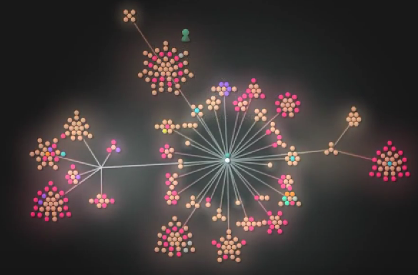
The development of the coding of all projects were carried on at Yale University. Each single point cluster identifies a project and each point in the cluster represents a scripting procedure.
Abstract:
In recent years there has been an explosion of geo-datasets derived from an increasing number of remote sensors, field instruments, sensor networks, and other GPS-equipped “smart” devices. “Big Data” processing requires flexible tools that combine efficient processing, either on your local pc or on remote servers (e.g, clusters – HPCs). However, leveraging these new data streams requires new tools and increasingly complex workflows often involving multiple software and/or programming languages. This also the case for GIS and Remote Sensing analysis where statistical/mathematical algorithms are implemented in complex geospatial workflows. I will show few examples of environmental applications where I combine different open-source geo-libraries for a massive computation at NASA Earth Exchange (NEX) Platform.
The animation has been produced by Gource with the following code line:
gource --file-idle-time 0 -s 1 --auto-skip-seconds 1 \\
--stop-at-end --title BTClient \\
--output-ppm-stream --r 25 /tmp/.git/ | \\
ffmpeg -y -r 25  -f image2pipe -vcodec ppm -i \\
--vcodec libx264 -preset medium -vprofile baseline \\
-level 3.0 -pix_fmt yuv420p gource.mp4